
Franko Maps Ca Santa Catalina Guide: Topographic Trail Maps
Franko Maps Ca Santa Catalina Guide: Topographic Trail Maps
Description
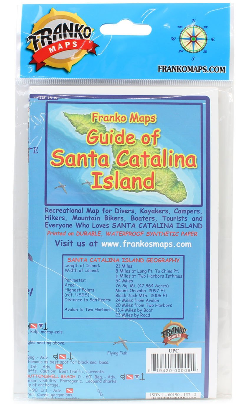
Santa Catalina Island: This colorful map gives you everything you need to know about Santa Catalina Island and its surrounding waters. The map is detailed with important facts about the island and what you will find on land or under the water. Complete depth depicted in descending hues of ocean blues to indicate actual ocean bathymetry and depth contours. Shaded relief accuracy is derived from USGS digital elevation models. Each dive spot is accurately described with what you will find when you dive the location along with depth and recommended things to look for. Side one covers the entire island with focus on locations, names and descriptions of diving and snorkeling sites. There are colorful illustrations of fish and other reef creatures found in the Catalina waters. Side two has larger scale contour maps of Avalon and Two Harbors with additional details, a map of Avalon Underwater Park, and information on transportation to and on Catalina, SCUBA, snorkel and tour suppliers. If you are planning a trip to the Island of Romance this map is a must. A comprehensive guide to this amazing island off the Orange County coast of California 14" x 21" (35.6cm x 53.3cm) and is folded to a handy 4" x 7" (10.2cm x 17.8cm) size, printed on waterproof rip-resistant synthetic material. This is a shaded relief topographic map. It shows dirt roads, dive sites, snorkel sites, moorings, campground, anchorages and more.
Item Details
Pickup Location
4031 Market Center Dr Suite 303
North Las Vegas, NV, 89030
Quality
Estimated Retail Price
$9.45
Buyers Premium
15%
Inventory Number
1052315700
Found in
Additional Details from the Manufacturer
This item information is coming from the manufacturer. Some of the details may vary from the Nellis Auction listing. Please check the Quality Rating and Notes for information specific to this listing
brand
Franko MapsMore features
- PLAN YOUR DIVE - This map of Catalina Island, California, provides essential dive and travel information, ensuring a safe and enjoyable underwater adventure.
- NAVIGATE WITH EASE - Featuring dimensions of 14" x 21", this map offers clear visual aids for identifying key dive sites and points of interest around the island.
- POCKET-FRIENDLY SIZE - The folded size of 4" x 7" makes it convenient to carry, offering practical advice and up-to-date info right at your fingertips.
- RELIABLE IN ANY CONDITION - Crafted from waterproof, rip-resistant synthetic material, this map withstands harsh marine environments, providing lasting value.
- EXPERTLY DESIGNED - Benefit from comprehensive content created by Franko Maps, ensuring accuracy and reliability for both novice and experienced divers.

See the deals
Get in on the action, thousands of new items added daily. Bid and win!
Start bidding now